Elvira Sánchez precipice Rincón belvedere
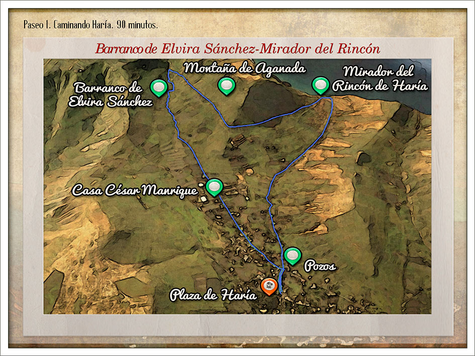
Hike number 1 – Stroll in Haría.
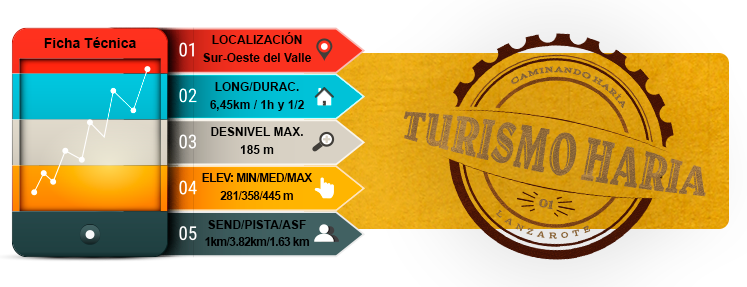
Features
Preferred
- TOTAL TIME: 1 h 30 min
- DEPARTURES: Haría square
- ARRIVALS: Haría square
- LEVEL: Easy
Introduction
- This course offers a singular sight for lovers of intense wilderness. Its uniqueness lies not only in the fact that this area is exceptionally rich in endemic species, but also in the way it concentrates the most interesting flora of the Risco de Famara. Due to its steep topography, orientation, and altitude between 400 and 600 meters above sea level, it is exposed to low mists of the trade winds, therefore maintaining ideal conditions for the development of a particular biodiversity.
- Moreover, the Rincón de Aganada also attracts quite a peculiar interest. This viewpoint offers a panoramic view of the west coast of the Island. It belongs to the Natural Park of the Archipelago Chinijo, in the Macizo Famara. Furthermore, it is classified Special Area of Conservation (SAC in English, ZEC in Spanish) of the Natura 2000 Network, and Important Bird and Biodiversity Area (IBA in English, ZEPA in Spanish).
- De camino de regreso a la Plaza de Haría, podremos observar la multitud de pozos al lado del Barranco, huella de la Cultura del Agua en este pueblo.
Routes
Constitución square
Haría city hall
César Manrique house museum
Uphill pathway starting from the main entrance of the Haría Football Field
Pathway gets narrower and narrower as the precipice approches
At the crossroads, take the dirt track to the right
Go around mount Aganada then arrive at Belvedere Rincón
Go down the dirt track to get back to the village…
MAP 1
DOSSIER GUIDE PDF
STROLL IN
Map in Google Earth
- If you do not have the free software Google Earth, you can download it from earth.google.com
- Download the route 1 in Google Earth format .(Kmz)
- Click the right button of your mouse on the track to see the elevation profile. Then click on “show elevation profile”