WALKING MÁGUEZ
Walk 5 – Walking Haría.
Features
Preferred
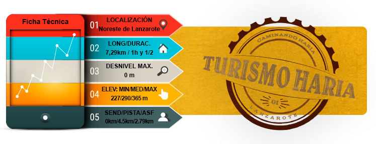
- Total time: 1 h 30 min
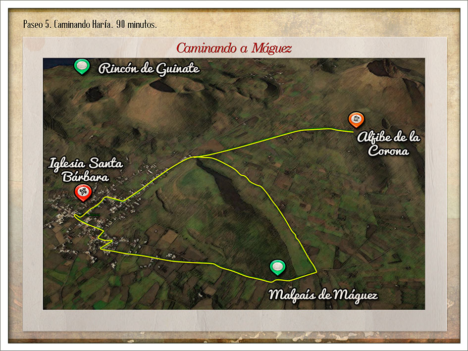
- Start: Máguez
- Finish: Máguez
- Difficulty: Easy
Introduction
- Máguez stands surrounded by volcanoes and mountains that form a high valley resulting from various periods of volcanic eruption. The volcanoes of Los Llanos, Los Helechos, Las Quemadas and La Atalaya watch over the town and the almost omnipresent La Corona Volcano can be seen off in the distance, creator of the Jameos and Los Verdes tunnels and caves.
- The houses in Máguez have been built using traditional Canarian architecture, with numerous grain stores now converted into usable rooms that are looked after lovingly by their owners.
- The walk explores this high plateau sculpted by volcanoes of different ages.
- From the Iglesia de Máguez, the route begins on the streets of this town. Be sure to observe the architecture of these typical Canarian houses in a mainly rural environment, where adaptation to the climate and working conditions has resulted in homes conceived and designed for crop and livestock farming activity.
- Leaving the town to the east, you enter a cropland area known as the Máguez badlands. Skirt around the eastern side of the Los Llanos mountain towards an open area among plots of land used to grow potatoes, onions, millet, vegetables and other plants.
- You will enter this area along a dirt track leading towards the west, skirting the northern face of the volcano on the Los Llanos mountain to discover a lesser known perspective on the Corona Volcano.
- Follow the dirt track to the north towards the foothills of the Corona Volcano to discover an old water storage cistern on the southern side of the volcano.
- Head back to Máguez along the same dirt track.
Route
Iglesia Santa Bárbara
Calle Buenavista
Máguez badlands
Los Llanos mountain
Water storage cistern
Calle las Casillas
MAP 5
DOSSIER GUIDE PDF
WALKING
Map in Google Earth
- If you do not have the free software Google Earth, you can download it from earth.google.com
- Download the route 5 in Google Earth format.(Kmz)
- Click the right button of your mouse on the track to see the elevation profile. Then click on “show elevation profile”.